Warm Water at the Shelf Break Shoots South
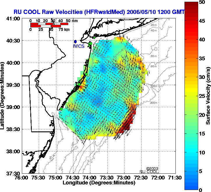
May 10: Here's the longest range Codar map of the day. The jet at the shelf break is still heading south around 50 cm/sec.
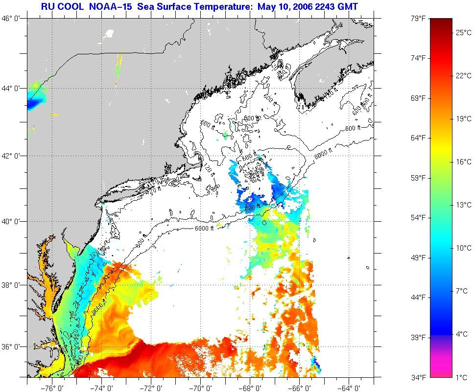
May 10: Clouds are clearing in the southern half of the Mid-Atlantic Bight.
Tonight's imagery shows that the warm water from the Gulf Stream Ring continues to head rapidly south along the shelf break, and now extends south to the Chesapeake Bay.
Notes: The surface data is pretty amazing. The biggest warm core ring I've ever seen, followed by this significant transport along the entire shelf break nearly to Hatteras. Maybe it will reach there by tomorrow, and be entrained back in the Gulf Stream. Just taking the long way to Europe. George Forristall and I had a drifter that did something like that once back in 1983 or 4. The big question that keeps coming up is what does the subsurface look like in that shelf-slope jet. The Rutgers COOL group prepped an underwater glider today to find out. It just returned from the LaTTE Hudson River Plume experiment after being deployed and recovered by the Oceanus. We added a little more weight today for the extra salinity we'll encounter, and we'll deploy it tomorrow from Tuckerton before the storm hits thursday night or friday. It will take us a few days to fly it out there, but I think we'll get their in time to find out how these gliders can operate in the strong currents we see out there. We'll also see how deep that thing is.
posted by Scott @ 5/10/2006
0 comments
![]()
![]()

0 Comments:
Post a Comment
<< Home